


The American West, known for its wide-open skies, towering mountains, and scenic vistas, can add another item to its list of natural wonders: extreme drought.
A drought to end all droughts
Fueled by the evolving nature of a changing climate, drought has ravaged the western half of the United States. Water supplies are dwindling in an area stretching from the Pacific Ocean to the Missouri River.1 Farmers and ranchers are suffering massive losses. Lakes are drying up. In California alone, most major water reservoirs are sitting at levels well below the historical average after the rainy season.2
Scientists have been closely monitoring the developing situation since 2000. The current mega-drought, exacerbated by recent heatwaves, has been classified as the worst regional drought in 1,200 years.3 Dry conditions are expected to continue for at least another year (and likely longer) in spite of relatively wet conditions in early January.
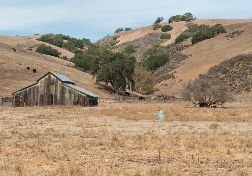
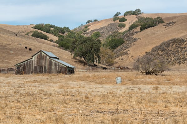 The Western United States is undergoing extreme drought conditions.
Related:
How Will the Drought Impact the Properties You Insure?
Making way for wildfires
Julie Cole, a climate scientist at the University of Michigan, describes how rising temperatures affect the earth.3 “The air is basically more capable of pulling the water out of the soil, out of vegetation, out of crops, out of forests,” states Cole. The vapor pressure deficit has increased significantly over the last 40 years and findings show that the average air temperature is increasing.5 Thus, more moisture is retained in the air causing drought conditions to become more extreme.
The threat of wildfire grows as drought conditions worsen and more moisture is pulled out of vegetation and forests.6 Wildfire fuels like grass, underbrush, shrubs and trees dry out and become more flammable, increasing the possibility of ignition.7 Scientists indicate that, as the global climate warms, the frequency in which drought conditions can persist will increase over time, magnifying all associated risks including wildfires. Historic mega-drought conditions have unleashed enormous wildfires in the western states with the problem expected to grow.
Most people live in metropolitan and suburban areas far from tinderbox forests. Recent news shows an increasing number are moving out of the cities and towards the periphery of undeveloped wilderness. Nearly 1.5 million people packed up and settled in regions known as double-hazard wildfire zones between 1990 and 2010.8
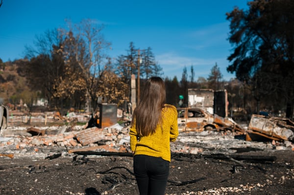 Living in a double-hazard zone amplifies the possibility of catastrophic loss.
Related:
Wildfires: What's the Most Common Cause?
Double-hazard zones
A Stanford University study pinpoints 18 specific locations in the western United States that are classified as double-hazard zones.
People are moving farther from cities and into the wildland-urban interface (WUI). Huge growth in these double-hazard zones, in tandem with increasing wildfire activity, puts life and property at risk.
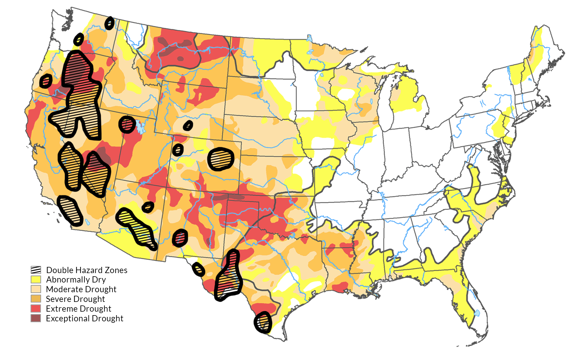
Research results discovered that the fastest population growth in the WUI is in areas that are most vulnerable to wildfires. More growth simply increases the number of people and buildings in harm’s way.
Use maps to find risk concentration
Extreme drought conditions, increasing frequency of wildfires and growing populations within susceptible areas make catastrophic wildfire exposure difficult to manage and maintain.
In partnership with GIA Map, we now offer tools that provide you with valuable data on current and future properties you insure. Receive integrated wildfire data, sensible wildfire scoring, analytics and mapping to see, understand and manage your concentration of wildfire risk.
Mitigate risk and help your customers get the coverage they need. Contact us to learn more about these tools.

[1] U.S. Drought Monitor, https://droughtmonitor.unl.edu/Maps/MapArchive.aspx
[2] California Data Exchange Center, https://cdec.water.ca.gov/resapp/RescondMain
[3] New York Times, https://www.nytimes.com/2022/02/14/climate/western-drought-megadrought.html
[4] New York Times, https://www.nytimes.com/2022/02/17/climate/noaa-weather-western-drought.html
[5] Sci Tech Daily, https://scitechdaily.com/stanford-researchers-identify-dangerous-double-hazard-zones-for-wildfire-in-the-west/
[6] Climate Science Special Report, https://science2017.globalchange.gov/chapter/8/
[7] Forest Service, https://www.fs.fed.us/rm/pubs_journals/2016/rmrs_2016_littell_j002.pdf
[9] The Hill, https://thehill.com/changing-america/sustainability/environment/593300-researchers-identify-double-hazard-zones-where
[10] The Conversation, https://theconversation.com/the-fastest-population-growth-in-the-wests-wildland-urban-interface-is-in-areas-most-vulnerable-to-wildfires-173410


