Go to WSRB
Go to BuildingMetrix
CREATE AN ACCOUNT
LOG IN

About the Company 

Who we are and how we help property insurers and agents throughout the U.S.

CEO Perspective

Engaging thought leadership on key insurance industry issues from our CEO. 

Meet the Team

Get to know the team of property insurance experts at WSRB, our parent company. 

InsuranceEDGE

Keep up with changes in the P&C industry with our weekly newsletter. 


Underwriting Guide to Cannabis & Hemp

An underwriter’s guide to risk and how to protect against it.

BuildingMetrix Blog

Learn about key insurance trends and how data helps you navigate them. 


Agency Guide to Earthquakes

Help your customers understand and be covered for earthquake risk.  

Case Studies

Discover customer success stories powered by BuildingMetrix solutions.


A Guide to Geospatial Technology

Harness the latest tools to achieve your underwriting goals.  

Help Center

Get step-by-step how-to articles on all BuildingMetrix data products.


A Guide to Wildfire Risk

Everything you need to know about managing this growing risk.

geospatial-page-banner

Advanced Geospatial Risk Analysis

 Interactive mapping technology to help underwriting and claims teams accomplish more  

Visualize the risks that matter most to you 

Underwriting is accelerating, and underwriters need specific insights to make optimal decisions about property risks. At BuildingMetrix, our mission is to help property insurers and insurance agents assess emerging risks and enhance their results with the right data analysis.


In pursuit of our goal, we have partnered with GIA Map, an underwriting solutions company that utilizes geospatial intelligence to improve risk selection, identify growth opportunities, and reduce exposure to catastrophic loss. GIA Map has identified the disadvantages inherent in current risk assessment methods, enabling them to construct a more effective system for evaluating risk. 

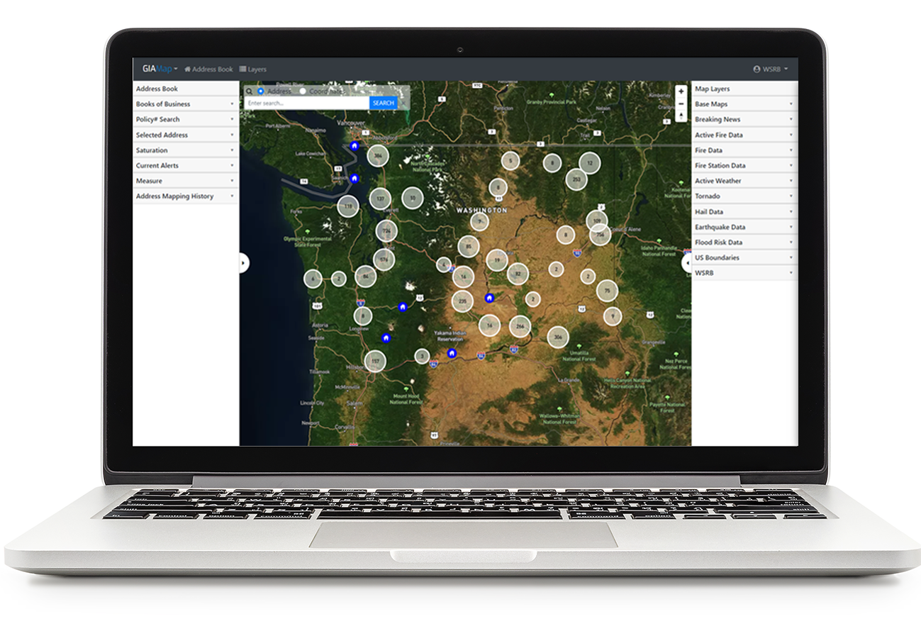
Central to GIA Map’s innovative approach to underwriting is its unparalleled use of geospatial intelligence. By aggregating risk data, book of business data, and analytics into GIA Map’s proprietary "mapplication", insurers can visualize their risk geographically, pinpointing any value saturation and opening avenues for productive management and growth. 

By harnessing the strides GIA Map has already made, we can provide BuildingMetrix customers with tools that allow them to effectively visualize their risk. As hazards evolve and underwriting time declines, our partnership aims to deliver data and tools to help underwriters get the job done.  

gia-map-logo-1

Accurately differentiate risks  

Through our partnership with GIA Map, you get access to data on wildfire, flood, earthquake, and severe weather risk at the address level, enabling underwriters to make more accurate decisions in less time. 

GIA Map analytics also give you the power to proactively manage risk, by taking a look at your entire book of business, by automatically checking new applications, or both. 

As hazards evolve and underwriting time declines, our partnership aims to deliver data and tools to help underwriters get the job done.  

Benefits of GIA Map

  • Accurate data – where current risk assessment methods offer rough estimates, geospatial intelligence eliminates need for guesswork, providing users exact dollar values 
  • All types of risk, all in one place – with map layers for 40+ natural hazard perils, including wildfire, flood, and tornado, users gain a comprehensive look at multiple types of risk information  
  • Real-time updates – in conjunction with historical risk data, constantly collected live information enables users to see risks as they develop instead of waiting for after the fact reports 
  • Full integration – on top of known risks, the incorporation of book of business data allows users to see their personalized risk saturation 
  • Analysis – through the application of intuitive algorithms, book of business analysis can quickly return important insights such as wildfire scoring and saturation 
gia-map-computer


More geospatial content

Learn more about which geospatial tool is right for you 

Talk to one of our GIS experts today.
TALK TO AN EXPERT